 
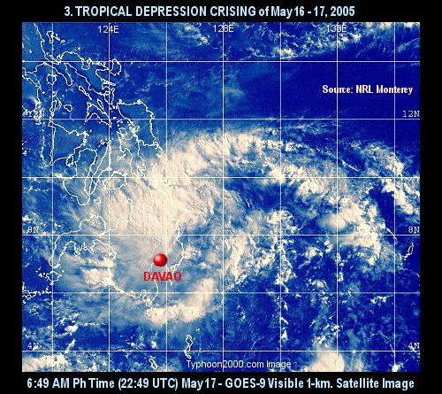
  Tropical Depression CRISING Tropical Depression CRISING
May 16 - 17
Max. Sustained Winds: 55 kph (30 kts)*
Min Central Pressure: 1006 mb
[Storm Log|Tracks: PAGASA]
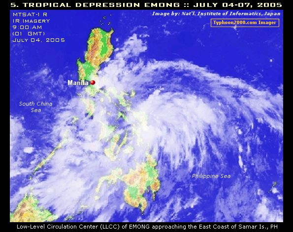
 Tropical Depression EMONG Tropical Depression EMONG
July 04 - 07
Max. Sustained Winds: 55 kph (30 kts)*
Min Central Pressure: 1004 mb
[Storm Log|Tracks: PAGASA/T2K|Post Data Obs: Graphic/Raw Text]
Home | Page [1] 2 3 4 Next... | Top
 - Deadly/Disastrous - Deadly/Disastrous
:: This summary is based on Tropical Cyclones within the Philippine Area of Responsibility (PAR) ::
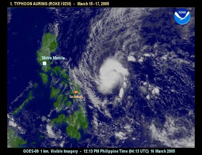
**Special thanks to Dr. Mark Lander for providing us the Microwave PDF images of Typhoon Roke [Note: Local names issued by PAGASA; In parenthesis are Int'l. names given by UN Typhoon Committee and
followed by JTWC's designated TC Number / Maximum Sustained Winds based on 1-Min. Average (JTWC)
except as indicated (*): based on 10-Min. Average (PAGASA) / Minimum Central Pressure by PAGASA or NRL Mon-
terey / JTWC Tracks by Hawaii Solar Astronomy (HSA) and JAXA-NASA / Storm's Summary courtesy of
Gary Padgett's Monthly Global TC Summary / Thumbnail and links images courtesy of NASA/GSFC,
NOAA-OSEI, NRL Monterey, & Central Weather Bureau of Taiwan / Aftermath Reports
courtesy of National Disaster Coordinating Council (NDCC)]
 
This page was last updated:
Sat, August 20, 2005 @ 1:07 UTC
|

