 
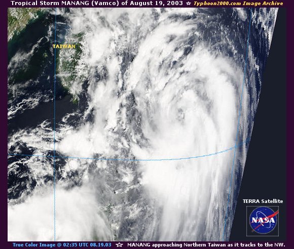
  Tropical Storm LAKAY Tropical Storm LAKAY
August 18 - 20
Max. Sustained Winds: 65 kph* (35 kts.)
Central Pressure: 998 mb.
[Storm Log|Tracks: PAGASA]
Back | Page 1 2 [3] 4 5 Next... | Top
 Storm Logs for Non-Philippine Tropical Cyclones Storm Logs for Non-Philippine Tropical Cyclones
 - Deadly/Disastrous - Deadly/Disastrous
:: This summary is based on Tropical Cyclones within the Philippine Area of Responsibility (PAR) :: [Note: Local names issued by PAGASA; In parenthesis are Int'l. names given by UN Typhoon Committee and
followed by JTWC's designated TC Number / Maximum Sustained Winds based on 1-Min. Average (JTWC)
except as indicated (*): based on 10-Min. Average (PAGASA) / Central Pressure by PAGASA or NRL Monterey /
JTWC Tracks by Hawaii Solar Institute and NASA / Storm's Summary courtesy of JTWC's 2003 ATCR /
Thumbnail images courtesy of NOAA-OSEI, NRL Monterey, & Central Weather Bureau of Taiwan /
Aftermath Reports courtesy of National Disaster Coordinating Council (NDCC)]
 
This page was last updated:
Sat, April 03, 2004 @ 05:57 UTC
| 

