A guide on tracking tropical cyclones

The threat of tropical cyclones nowadays is far reaching. Year after year, our civilization is affected by these howlers ranging from hurricanes, typhoons, cyclones and storms which belong to the family of tropical cyclones. This wrath of nature kills hundreds or even thousands of people, damaging many livelihood and properties. Now the question is: "How can we avoid them?" The answer to this is through awareness and understanding. Without this knowledge, the loss of lives will continue to be a risk factor in the evolution of civilization.

We welcome you to our special section: A Guide on How to Track Tropical Cyclones. This simple tool will help you know and understand where a tropical storm or a typhoon is going to strike. 
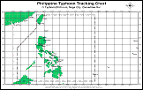
Below is a step-by-step procedure on how to do it:

>> Tracking a Typhoon: How to do it. <<
Step 1
Step 2
Step 3

  • Two (2) New Tracking Charts are added for your interest.
    To save file, right click and "save target_as":

    » NW Pacific: GIF | MS Word
    » Philippines: GIF | MS Word
    » Philippines: GIF (with distance)
  • Get the latest tropical cyclone information from your chosen agency (eg. PAGASA, JTWC, JMA) thru this website, the radio, TV, print or other sources. See example on Step 2 on what data to get.


  • Make sure to make a tabular form or your own storm logs on your computer or on a piece of paper for you to jot down the present data info and of course the future data.


  • Start plotting the present storm. For example: Super Typhoon Rosing (Angela) of November 02, 1995. Click here to get sample data information.


  • Plot the coordinates by finding out the exact square where Rosing is located. For this exercise, you need the first set of latitude and longitude - 14.4 north and 125.9 east. Now, look along the borders of your tracking chart the coordinate numbers 14 north and 125 east. You must converge 14 and 125 in one point, which will be 14.0 and 125.0.


  • Having located the coordinates, your next task is to pinpoint the precise location. Calculate 14.4 and 125.9 by dividing the coordinate box into 10 equal parts.  Click here    to view the illustration in Flash MX.

  • After plotting the exact position of the storm, you must also plot the forecast positions as well as the past positions of the storm - for you to know where and when the storm will strike. Don't forget to add the date, wind speed and the line connecting the points.


  • Here is a sample of a finished tracking chart   of Rosing (using Flash MX) taken from the example data information in Step 2.


  • Upon knowing where the storm is, you can now share the information to anybody in your community. Who knows, you can be a hero someday by saving lives. Now,  in order to master the plotting of these tropical cyclones you need to repeat from Step 1 again.  Always remember, "practice makes perfect!" Good luck!

» Don't have the required viewer or player? Select and click below to download:

click to get one FREE!   click here for free download!

Back to Previous Page

Copyright © 2002-2006 Typhoon2000.com  All Rights Reserved